One Earth, Many Projections
One Earth, Many Projections
Couldn't load pickup availability
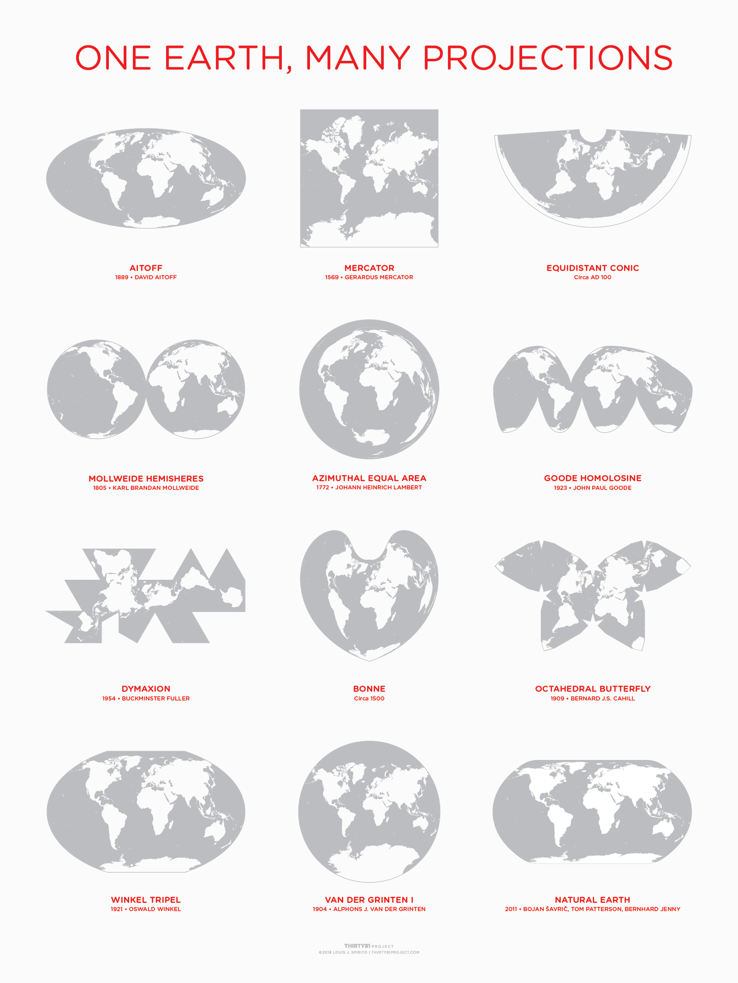
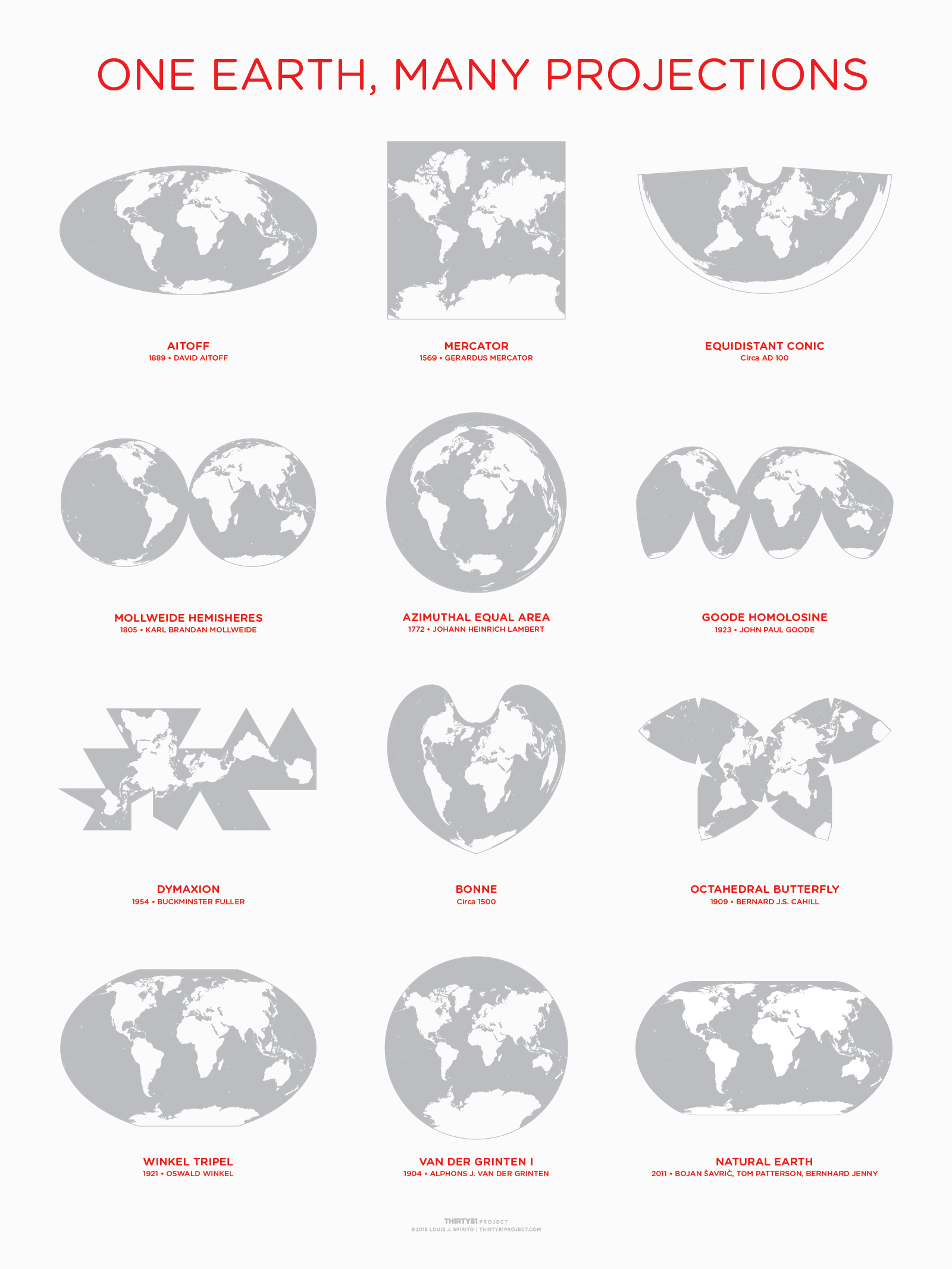
How do you draw a three dimensional globe onto a flat sheet of paper? Cartographers have been unraveling this question for centuries, using mathematics and technical drawing skill to interpret the physical earth onto a flat plane. Each of the map projections shown on this poster display the same information — the surface of the earth — using twelve different formulas. It is a concise yet wholly incomplete history of projections spanning 2,000 years from about 100 AD to 2018.
This 18x24 poster is printed with a shimmering Silver Metallic ink for the maps and PMS Red 32 for text.
Produced: September, 2018
Dimensions: 24" x 18"
Printing: Two-color serigraph
Paper: 100# Cover French Paper Co. Smart White
Typeset: Hoelfer & Co. Gotham Rounded
Printer: Vahalla Studios, Kansas City, MO.
$30.00 + tax where applicable.
Shipping for U.S. and Canada calculated at checkout.
Domestic Shipping: We ship posters via USPS Ground Advantage using heavy duty shipping tubes and StayFlat envelopes to ensure your order arrives in new condition.
International Shipping: We are currently shipping to addresses in the United States and Canada only. Customers are responsible for any customs and/or duty fees.
Original artwork © 2018 Louis J. Spirito | THIRTY81 Project
May not be copied or reproduced in any way including derivative works without express written permission.
Share